
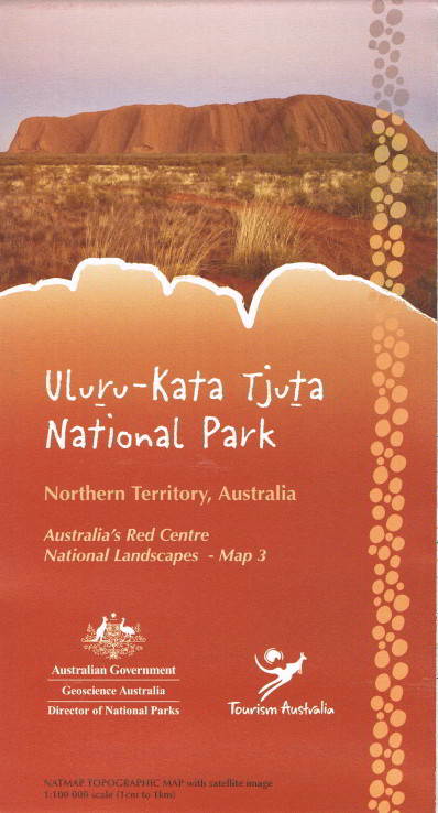
Uluru - Kata Tjuta National Park
Scale 1:100 000 Opened Size: 995 x 700 mm
The map covers an area of 0.82 degrees longitude by 0.92 degrees latitude or about 82 kilometres from east to west and about 63 kilometres from north to south. This map contains natural and constructed features including roads, foot tracks, hydrography, vegetation, contours (interval 20m), localities and some administrative boundaries. The reverse side of the map depicts the same area using a satellite image with an overlay of major roads, foot tracks, tourism features and facilities as well as insets featuring Uluru, Kata Tjuta and Yulara. This is map 3 of Australia's Red Centre National Landscapes series.