
Tasman Peninsula Topographic Map
TASMAP is progressively introducing a 1:50 000 Topographic Mapping Series.
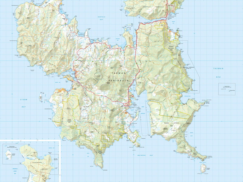
The map covers the entire Tasman Peninsula. The Tasman National Park,
renowned for its spectacular coastal scenery, diverse forests and newly
opened Three Capes Experience, is a prominent feature of the area.
Additionally, two Historic Sites at Port Arthur and Coal Mines, both
inscribed on the World Heritage List as part of the Australian Convict
Sites World Heritage are popular with visitors. The coastal conditions
vary from huge waves for surfers to sheltered bays sought by
recreational fishers and boat owners.
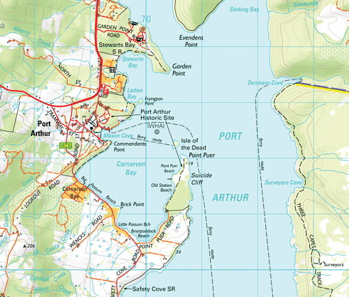
The 1:50 000 Map Series provides clear and accurate portrayal of
topographic information, with symbols and map content giving enhanced
depiction of buildings, hill shading and a simplified classification of
vegetation.