
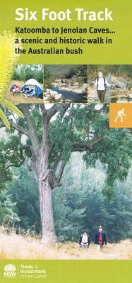
Six Foot Track Map - Bushwalking
Supplied in a plastic pouch.
It usually takes three days to walk the whole track, but shorter walks can also be taken on sections of the track where road access is possible, making the track a perfect day trip or overnight camping experience. Steeped in history, the track begins at the Explorers' Tree on the great Western Highway between Katoomba and Medlow Bath and heads down into the Megalong and continues through the valley, following the Cox's River, which you will cross by the Bowtells Swing Bridge before arriving at the Cox's River campsite. The next section takes you over the Mini Mini Saddle to the Alum Creek campsite. From here, climb up the Black Range to the highest point of the track before heading down the Binoomea Ridge to Jenolan Caves.