Maps, Infographics and the Visual World
The emergence of digital media has allowed us to share much more information than ever before. The written word is cumbersome in this visual age. Photos, graphics, charts and animation all now play an important role is getting your message across.
Maps have always filled this purpose but are coming into their own like never before. No longer merely to get you from A to B, a map can tell you so much more.
There are some great examples of maps as infographics on the web. And our range is now bigger than just street directories and topographic maps, too.
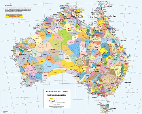
The Aboriginal Australia Map illustrates the large groupings of aboriginal people; research carried out for the Encyclopaedia of Aboriginal Australia.
Dedicated Postcode Maps and Local Government Area maps highlight features other than just roads and towns and have a variety of business applications.
And for the more traditional recreation uses, publications like Outdoor Recreation Guides and Outback Travellers Track Guides are value-added products giving notes, descriptions, points of interest and other data with the map.
")