
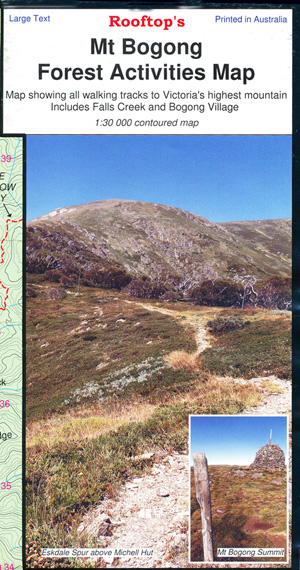
Mt Bogong Forest Activities Map
Coverage includes all walking tracks to Mount Feathertop; Harrietville, Upper West Kiewa River, Mount Hotham, Dibbins Hut, and an inset map for walks near Dinner Plain.
Facility symbols include Bush Huts, Toilets, Parking, Camping and Walking Access Only.
The 1:50,000 scale map also includes, roads, vehicle and walking tracks, contours, elevations, GPS co-ordinates and grid references for major points of interest.
Main Locations on this side:-
Mt Feathertop, Harrietville, Little Mt Fearthertop, West Spur Walk, Tawonga Huts, Tobais Gap, Tom Kneen Walking Track, Pinch Gut Lane, MUMC Hut, Nyrob Hut, Westons Hut, East Oven Track, Red Robin Mine Site, Dibbins Hut, Cobungra Gap, Federation Hut, High Knob, Red Robin Gap, Machinery Spur Track, Razorback Walking Track, Dibbins Track, Diamatina Walking Track, Bon Accord Spur Walking Track, Mt Loch, Mt Hotham, Mt Higginbottom, Mt St Bernard, Mt Blowhard, Diamatina Spings and Hut, Silver Brumby Hut, Paling Spur, Quintet Mines Hute Site, part of the Alpine Walking Track, Swindlers Gap, Youngs Hut, Mt Little Baldy, Brandy Creek Track