
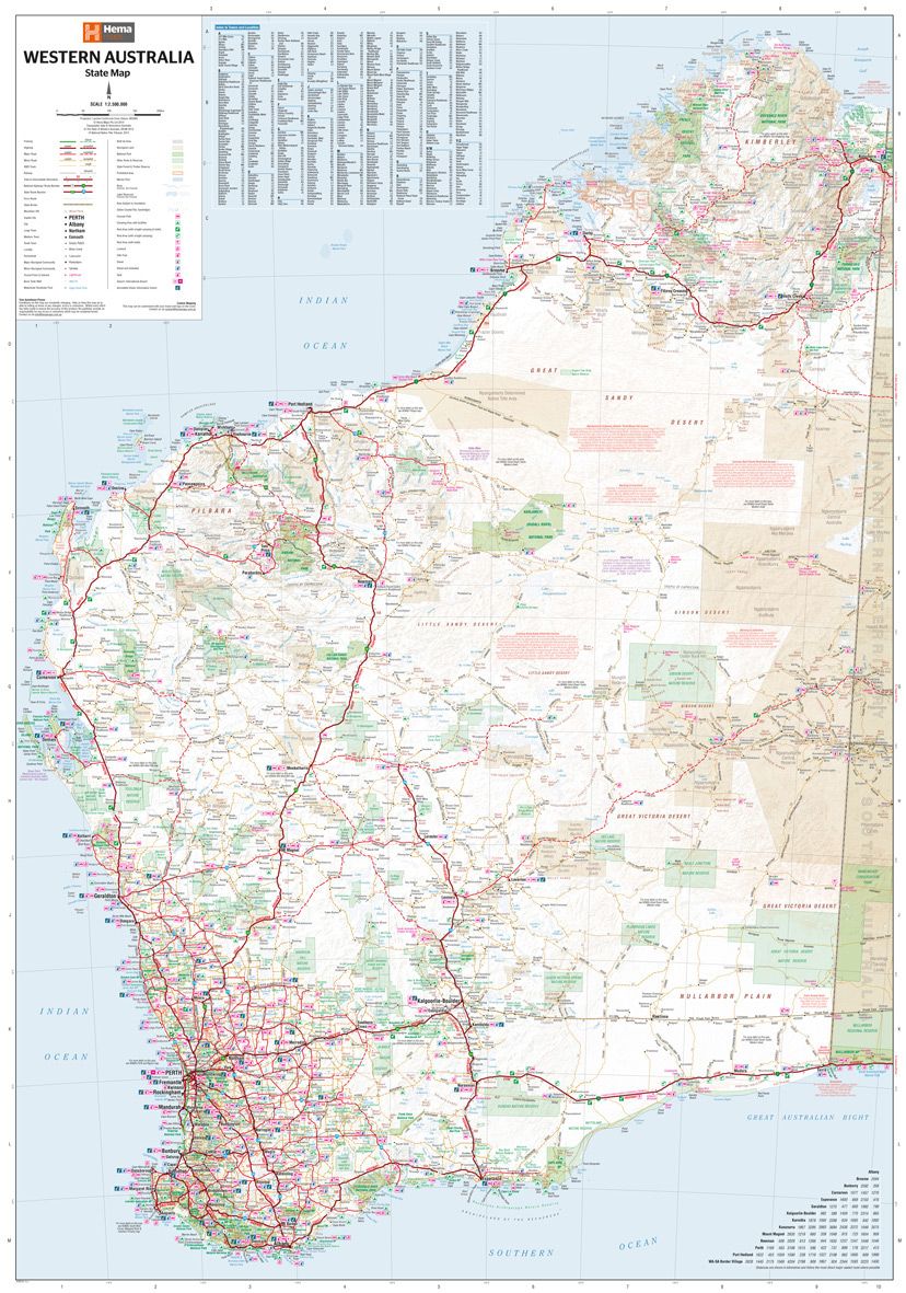
Western Australia
A state touring map of Western Australia (WA) featuring: On the reverse side of the maps are the CBD and through road maps of
Perth, plus inset maps of Leeuwin-Naturaliste National Park, Cape Range
National Park, Nambung National Park, Francois Peron National Park,
Purnululu National Park, Walpole-Nornalup National Park and Karijini
National Park. Also included are listed national parks and information
centres within Western Australia. Edition: 11th Publication Date: 01/11/19 Scale: 1:2,500,000 Folded size (WxHxD): 140mm x 250mm x 3mm Flat size (WxH): 700mm x 1000mm Weight: 0.09kgsWestern Australia State Map (11th Edition)
Key Specifications