
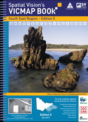
VicMap Books South East Region
3rd Edition 25cm wide and 34cm high
IDEAL FOR: Four wheel driving, camping, bushwalking, mountain biking, fishing, business travel and car touring.
MAJOR NATIONAL AND STATE PARKS: Yarra Ranges, Bunyip, Cape Liptrap, Wilsons Promontory, Moondarra, Baw Baw, Tarra-Bulga, Alpine, Avon, Holey Plains, Mitchell River, Gippsland Lakes, The Lakes, Lake Tyres, Snowy River, Kosciuszko, Cape Conran, Errinundra, Lind, Coopracambra, Alfred, Croajingolong, Nadgee.
Note: In most places this edition extends at least 20 kms over New South Wales border.
SCALE: South East Region: 1:100,000 Selected areas: 1:50,000 Township maps: 1:20,000 Wilsons Promontory: 1:150,000
COVERAGE:
Both sides of the Murray River
South West to Wonthaggi, Inverloch, Korumburra, Fish Creek, Buffalo, Leongatha, Wilsons Promontory
South East to Mallacoota, Gabo Island
South to Lakes Entrance, Bairnsdale, Orbost, Bruthen, Golden Beach – Paradise Beach, Flamingo Beach
North West to Marysville, Healesville – Badger Creek, Woods Point, Baw Baw Alpine Village
North to Mount Buller Alpine Village, Towonga, Mt Beauty – Tawonga South, Falls Creek.