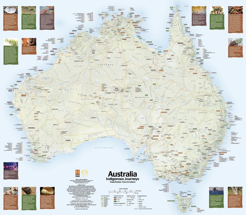
Australia Indigenous Journeys
For over 40 years, Hema Maps has guided travellers across Australia’s diverse landscapes. Our latest release, the Australia Indigenous Journeys Map, is a landmark cultural map that highlights the ancient Songlines, trade routes, and cultural pathways travelled by Australia’s First Peoples for over 65,000 years. Developed with guidance from Aboriginal and Torres Strait Islander communities, this map features 250+ Indigenous language groups and key cultural sites. It’s more than a navigation tool
Explore the Songlines of the World’s Oldest Living Culture
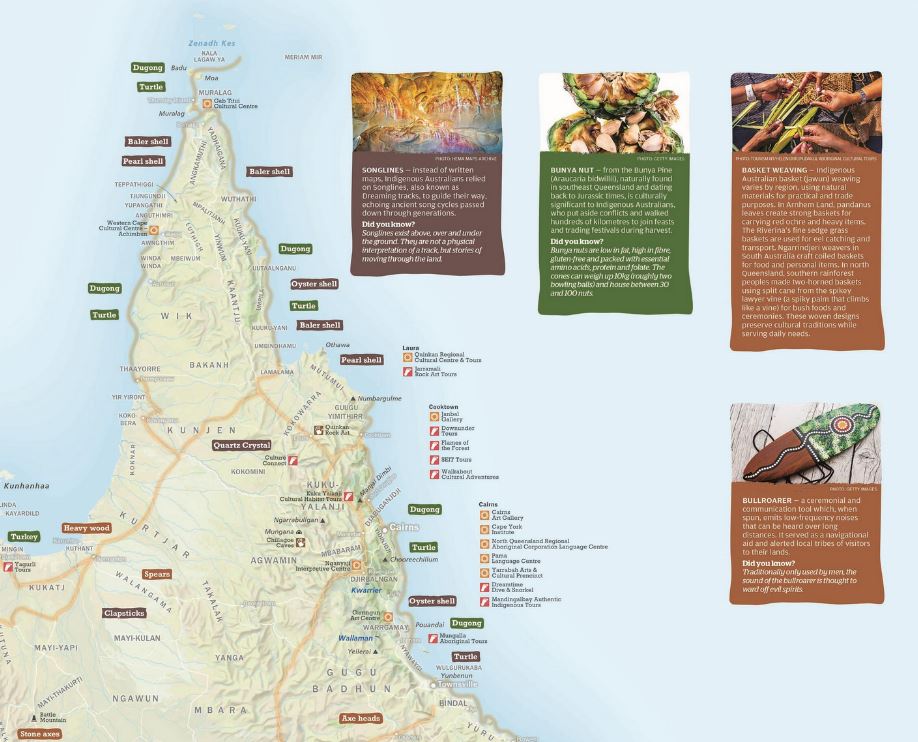
For more than 65,000 years, Aboriginal and Torres Strait Islander Peoples — Australia’s Traditional Owners — have walked the land, forging trade routes, sharing knowledge and caring for Country. The Indigenous Journeys Map honours these enduring connections with Country through a detailed, respectful and uniquely comprehensive representation of ancient trade routes, cultural pathways and songlines.
Map Features:
- Detailed Trade Routes & Pathways
Follow the routes shaped by trade, ceremony, kinship and seasonal patterns across the continent — some extending thousands of kilometres, guided by waterholes, gathering places and creation stories.
- Indigenous Cultural/Art Centres
Continue your learning journey with Aboriginal experience centres marked on the map.
- Traded Goods & Cultural Exchange
Learn about the vast array of resources traded — from ochre, shells and stone tools to ceremonial goods and native plants — and the vibrant networks that made it possible.
- 250+ Indigenous Language Groups
Presented with cultural sensitivity and acknowledgment of AIATSIS sources, these names highlight the diversity and complexity of Indigenous Australia before colonisation.
- Authentic Landscape View
See how the Australian landscape may have appeared when it was solely inhabited by Indigenous Peoples, including traditional names for key places.
A Collaborative Cultural Resource
Born from the collaboration between Hema Maps and geologist/explorer James Allen, this map was created with insights gathered during extensive travels across the continent (2020–24). It reflects guidance from Traditional Owners and cartographic expertise from Gunditjmara man, Craig Molyneux. We also acknowledge Shelley Thomas for her work coordinating the multiple stakeholders associated with this project.
Hema Maps acknowledges all Traditional Owners and Elders, past and present, and is committed to best practices for the protection of Indigenous cultural and intellectual property.
Key Specifications:
- Edition: 1st
- Publication Date: 01/07/2025
- Scale: 1:5,500,000
- Flat Size (WxH): 1000mm x 875mm
- Weight: 0.09 kg
- Publisher: Hema Maps
- ISBN/Barcode: 9781923354081
Perfect For:
- Outdoor adventurers and travellers seeking deeper cultural connection
- Educators and students exploring Indigenous culture and geography
- Families wanting to foster awareness and respect for Australia’s First Nations cultures
- Gift shoppers looking for a meaningful and educational present
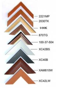
Available Options
Laminated Wall Map $129.95
Hang Rails $279.95
Aluminium Frame 10mm $345.00
Aluminium Frame 35mm $395.00
Wooden Frame $437.00