

Tasmap 1:50 000
The design of the 1:50 000 Map Series provides a clear and accurate
portrayal of topographic information, with symbols and map content
giving enhanced depiction of buildings, hill shading and a simplified
classification of vegetation.
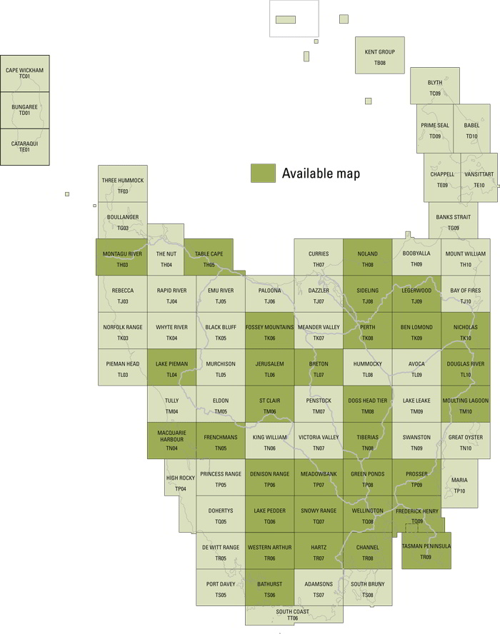
The 1:50 000 Series covers the entire State with 80 maps and is under
active revision. Each map covers a 30 x 40 kilometre area with a 1
kilometre grid based on the Map Grid of Australia (MGA94) which utilises
the Geocentric Datum of Australia 1994 (GDA94). At this scale, 1
millimetre on the map represents 50 metres on the ground.
Initially maps will be produced in areas where 1:25 000 maps are both
out of stock and in high demand, combining the best features of the 1:25
000 and 1:100 000 mapping series
| Model | Name | Price | Quantity | Add To Cart |
|---|---|---|---|---|
| TS06 | Bathurst |
$12.95
|
||
| TK09 | Ben Lomond |
$12.95
|
||
| TL07 | Breton |
$12.95
|
||
| TR08 | Channel |
$12.95
|
||
| TP06 | Denison Range |
$12.95
|
||
| TM08 | Dogs Head Tier |
$12.95
|
||
| TL10 | Douglas River |
$12.95
|
||
| TK06 | Fossey Mountains |
$12.95
|
||
| TQ09 | Frederick Henry |
$12.95
|
||
| TN05 | Frenchmans |
$12.95
|
||
| TP08 | Green Ponds |
$12.95
|
||
| TR07 | Hartz |
$12.95
|
||
| TL06 | Jerusalem |
$12.95
|
||
| TQ06 | Lake Pedder |
$12.95
|
||
| TL04 | Lake Pieman |
$12.95
|
||
| TJ09 | Legerwood |
$12.95
|
||
| TN04 | Macquarie Harbour |
$12.95
|
||
| TP07 | Meadowbank |
$12.95
|
||
| TH03 | Montagu River |
$12.95
|
||
| TM10 | Moulting Lagoon |
$12.95
|
||
| TK10 | Nicholas |
$12.95
|
||
| TH08 | Noland |
$12.95
|
||
| TK08 | Perth |
$12.95
|
||
| TP09 | Prosser |
$12.95
|
||
| TJ08 | Sideling |
$12.95
|
||
| TQ07 | Snowy Range |
$12.95
|
||
| TM06 | St Clair |
$12.95
|
||
| TH05 | Table Cape |
$12.95
|
||
| TR09 | Tasman Peninsula |
$12.95
|
||
| TN08 | Tiberias |
$12.95
|
||
| TQ08 | Wellington |
$12.95
|
||
| TR06 | Western Arthur |
$12.95
|