
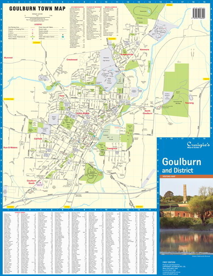
Goulburn & District
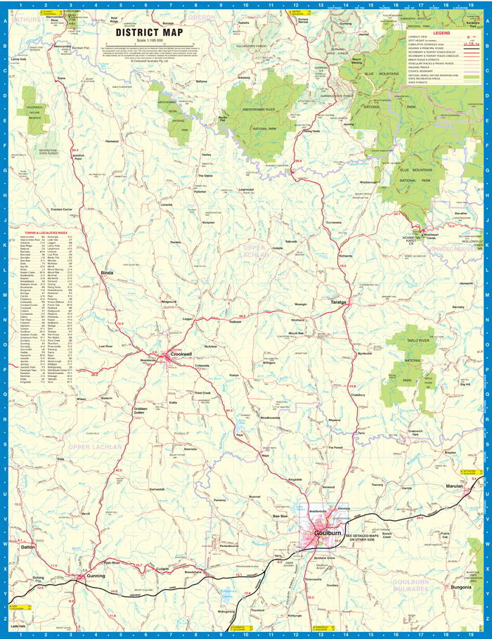
The Goulburn & District Map extends from Kanangra Tops in the North to Gunning in the South, Hanworth in the East and Crooked Corner in the West.
Including detailed Street Maps of Goulburn, Bradfordville, Crestwood, Eastgrove, Ilfield, Garfield, Goulburn South, Kenmore, Mummel, North Goulburn, Run-o-waters
District Map Scale 1:195,000
Street Map Goulburn Scale 1:20,000
$29.00